|
[ UrbanRail.Net ] [ Europe ] [ Americas ] [ Asia ] [ Africa ] [ Oceania ] [ News ] [ Books ] [ Links ] |
|
NEW
YORK CITY
|
| New York . USA |
|
[ UrbanRail.Net ] [ Europe ] [ Americas ] [ Asia ] [ Africa ] [ Oceania ] [ News ] [ Books ] [ Links ] |
|
NEW
YORK CITY
|
| New York . USA |
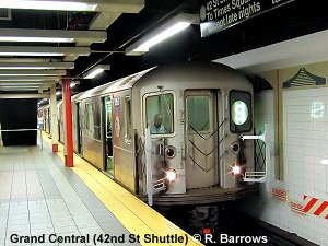
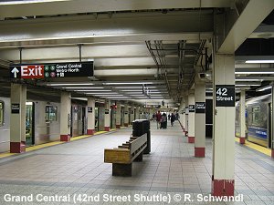
Lines and Routes | History | Projects | PATH | Other Rail Transit | Books | Links
| System | ||
|
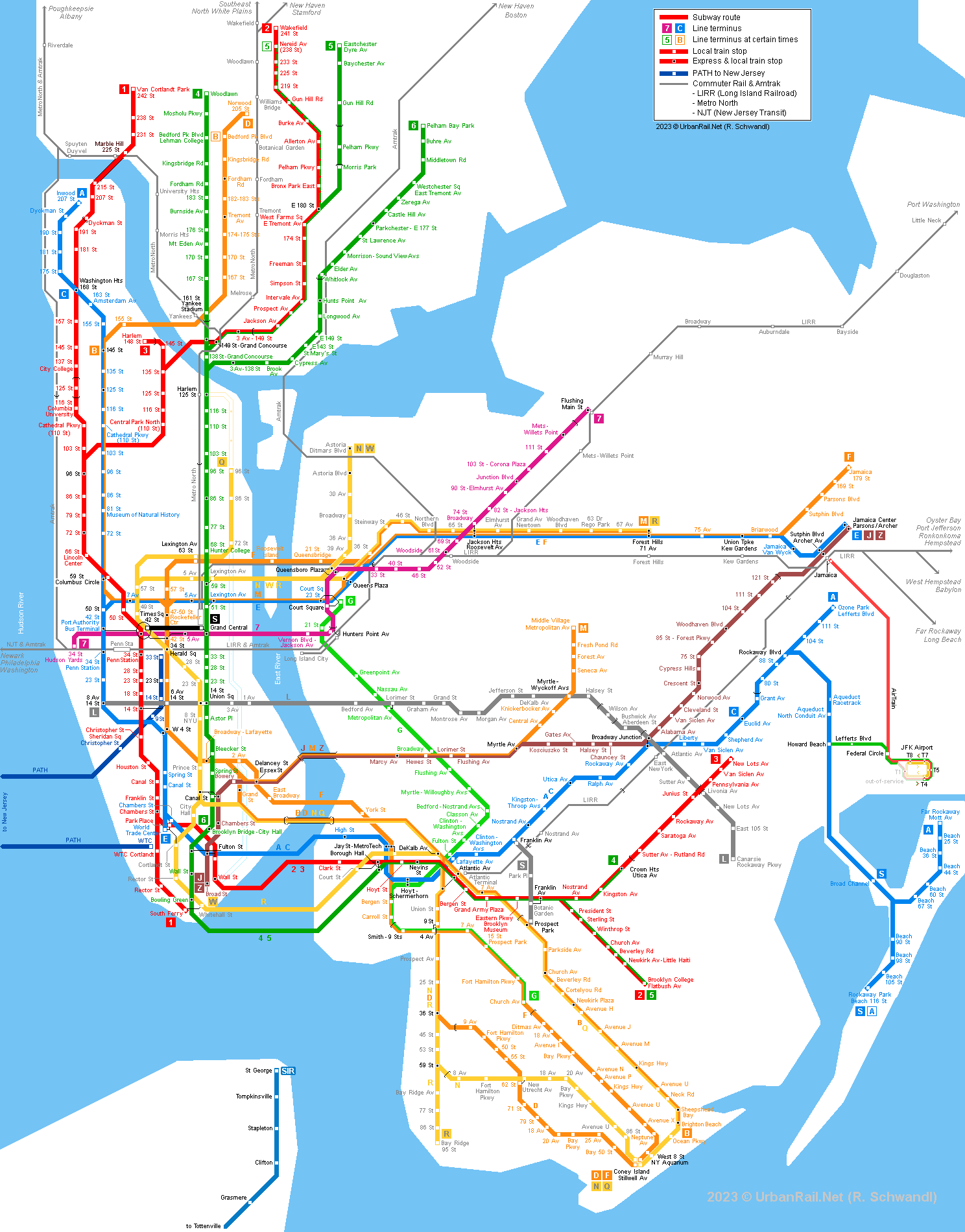
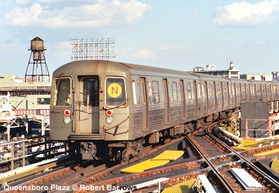
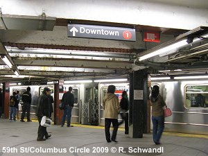
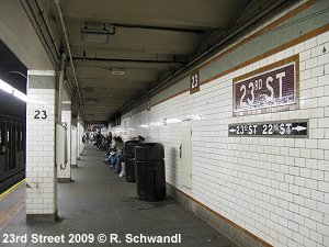
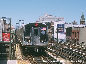
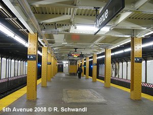
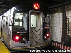
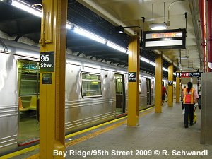
Numbered lines correspond to the older small-profile IRT (Interborough Rapid Transit) network, whereas letter-coded lines were once the BMT (Brooklyn-Manhattan Transit) or the IND (Independent Subway) network. The three systems were merged in 1940, but the larger trains of the BMT/IND system cannot operate on the IRT routes.
|
 |
|
| PROJECTS |
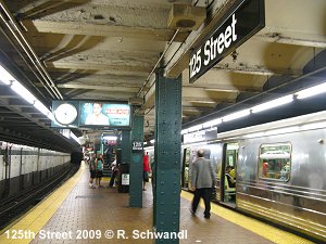
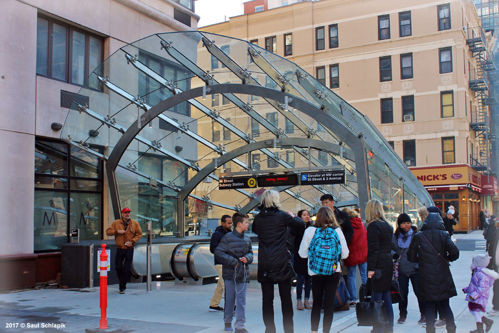
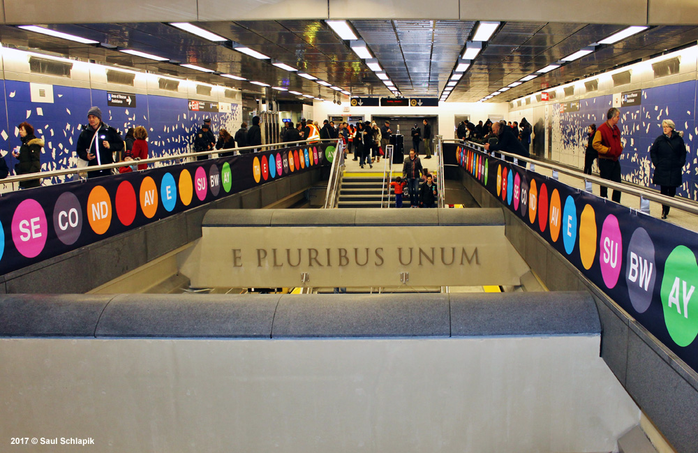
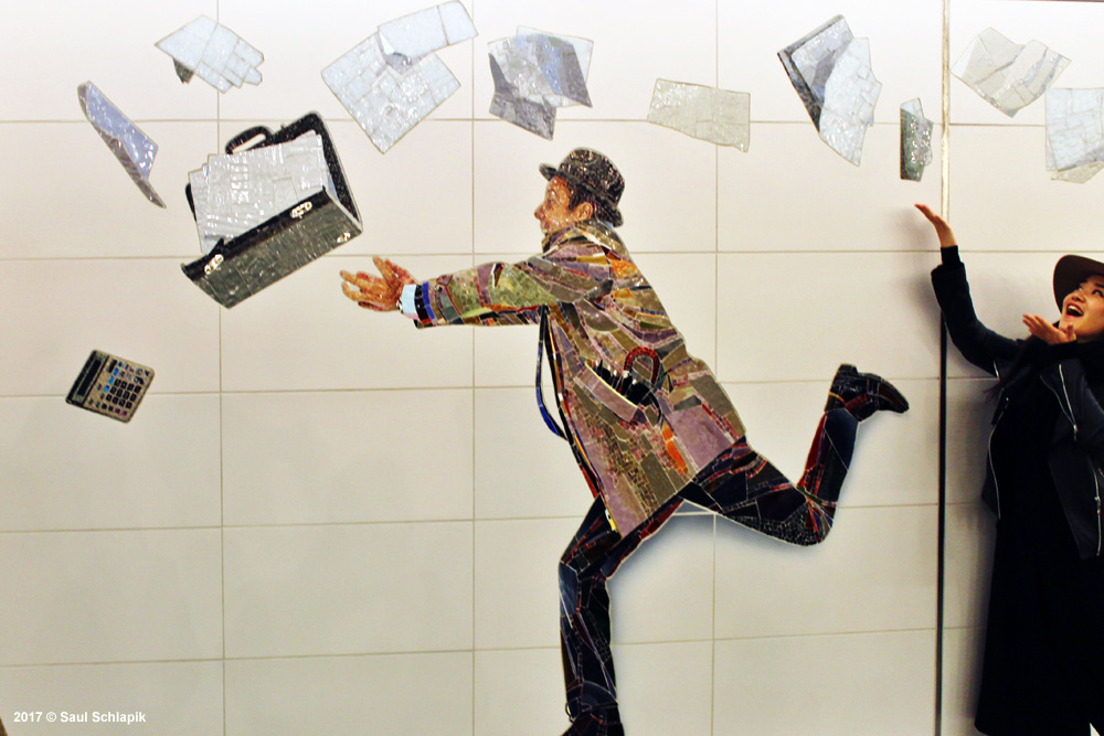
Second Avenue Subway:
For many decades a new route has been planned along 2nd Avenue. In spring
2007, the first phase of construction was started from
the present NQR station at 57th Street/7th Avenue (Broadway Line) to 96th
Street on 2nd Avenue. The tunnel between 57th Street and Lexington Av/63 St
stations already existed, so the new construction actually only included the
section between Lexington Av/63 St and 96th Street. The first phase was eventually
completed in 2017. In
a second stage, the northern extension to the hub at 125th Street will be
built. Find
out details here.
| OTHER RAIL TRANSIT IN THE NEW YORK METROPOLITAN AREA | ||
| .. | ||
| |
||
|
|
||
| |
||
|
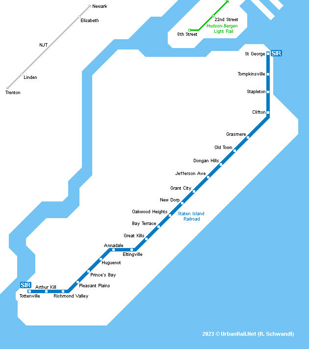
This 22 km railway line runs along the eastern side of Staten Island, New York's fifth borough. Except for a short tunnel near St. George the entire line is aboveground and has 22 stations. At the northern terminus it connects to the ferry from Manhattan (near South Ferry station). Subway MetroCards and tokens are valid on this line. 21 Jan 2017: Arthur Kill station added between Richmond Valley and Tottenville at the southern end of the line, replacing the former stops Nassau and Atlantic.
|
  |
|
| |
||
|
The Long Island Rail Road serves almost any part of Long Island with various branches spreading out east from Jamaica station in Queens. From this station some trains run west to Atlantic Terminal (Flatbush Av.) in downtown Brooklyn, a few terminate in Long Island City in Queens, but most run through to Manhattan's Penn Station. A second route to Manhattan (Grand Central Madison) - East Side Access - eventually opened on 25 Jan 2023, with an initial shuttle service between Jamaica and Grand Central Madison. Find out details here.
|
||
| |
||
|
The Metro-North Commuter Railroad operates from Grand Central station and serves the areas north of New York City with one branch reaching as far as New Haven in Connecticut. There is a major interchange with subway lines at 125 St and 12 stations lie in the Bronx. MetroCards are not valid and fares are according to distance.
|
||
| |
||
|
Find out more here! |
||
| |
||
|
New Jersey Transit (NJT) operates two light rail systems in Northern New Jersey, the Newark Light Rail and the Hudson-Bergen Light Rail, as well as an extensive network of commuter rail lines from its Hoboken Terminal on the western shore of the Hudson River, which can be reached from Manhattan by PATH. Some NJT trains run through to Penn Station in Manhattan. For more on urban rail in New Jersey click here!
|
||
| LINKS |
MTA - Metropolitan Transportation Authority Homepage Official Page
NYC SUBWAY RESOURCES has everything you might be looking for on the New York City Subway
New York City Subway at Wikipedia
The SubwayNut by Jeremiah Cox incl. 100s of station photos
The New York Transit Scenes by Saul Blumenthal
Great map (235K) including all rail services in New York and adjacent New Jersey by Joseph Brennan
Abandoned stations in New York and around by Joseph Brennan
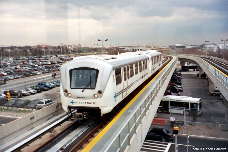
Robert Barrows' New York Gallery
| Books on the NYC Subway | ||
|
New York Transit Museum: Subway Style: 100 Years of Architecture & Design in the New York City Subway. - Oct. 2004, 252 p., 12' x 9', Stuart, Tabori and Chang; ISBN 158479349X Gene Sansone: New York Subways: An Illustrated History of New York City's Transit Cars, 1867-2004. - Nov. 2004, Johns Hopkins Univ Pr; ISBN: 0801879221 Lorraine B. Diehl: Subways: The Tracks That Built New York City. - Sept. 2004, Clarkson Potter; ISBN: 1400052270 Stan Fischler: The Subway and the City. - July 2004, 568 p., Frank Merriwell Inc., ISBN 0837395518 David Weitzman: A Subway for New York. - June 2004, 40 p., Crown Books for Young Readers; ISBN: 0375925376
Randy Kennedy: SUBWAYLAND: Adventures in the World Beneath New York. - Feb. 2004, 240 p., Griffin Trade Paperback; ISBN 0312324340 New York Transit Museum: New York City Subway Trains: 12 Classic Punch and Build Trains. - Dec. 2003, 48 p., Gibbs Smith Publisher; ISBN 1586853244
|
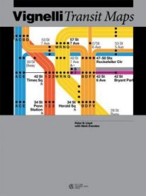
Vignelli Transit Maps The history of the NYC subway maps by Peter B. Lloyd and Mark Ovenden Click here for more info!
|
|
|
Brian J. Cudahy: A Century of Subways: Celebrating 100 Years of New York's Underground Railways. - Oct. 2003, 360 pages, Fordham University Press, ISBN 0823222926 Gene Sansone, Clifton Hood: Evolution of New York City Subways: An Illustrated History of New York City's Transit Cars, 1867-1997. - March 2002, 424 p., Johns Hopkins Univ Pr; ISBN 0801868866 Martin W. Sandler: Straphanging in the U.S.A: Trolleys and Subways in American Life (Transportation in America). - June 2003, 48 pages, 8.50' x 10.25', Oxford University Press, ISBN 0195132297
Brian J. Cudahy, George M. Smerk: How We Got to Coney Island: The Development of Mass Transportation in Brooklyn and Kings County. - Dec 2002, 320 pages, Fordham University Press, ISBN 082322208X William D. Middleton: Metropolitan Railways: Rapid Transit in America (Railroads Past and Present). - January 2003, 400 pages, Indiana University Press, ISBN 0253341795 Sr Range Tom: New York City Subway (Postcard History). - 128 p., 0.33 x 9.22 x 6.60 inches, Arcadia, 2002 ISBN 0738510866 Christopher Payne: New York's Forgotten Substations: The Power Behind the Subway. - 2002, Princeton Architectural Press, ISBN 1568983557 Brian J. Cudahy: Rails Under the Mighty Hudson: The Story of the Hudson Tubes, the Pennsylvania Tunnels and Manhattan Transfer (Hudson Valley Heritage, 2). - June 2002, 112 p., Fordham Univ Pr; ISBN 0823221903 Kurt C. Schlichting: Grand Central Terminal: Railroads, Engineering, and Architecture in New York City. - April 2001, 208 pages, Johns Hopkins Univ Pr; ISBN 0801865107 James Clifford Greller: New York City Subway Cars. - 166 p., XplorerPress.com, ISBN 0946576503 Derrick, Peter: TUNNELING TO THE FUTURE: The Story of the Great Subway Expansion That Saved New York. (Jan 2001) Frattini, Dave: THE UNDERGROUND GUIDE TO NEW YORK CITY SUBWAYS. April 2000, 352 pages Hood, Clifton: 722 MILES : The Building of the Subways and How They Transformed New York Simon & Schuster, NY, 1993. Rather a novel, with only a few photographs. Cudahy, Brian J.: UNDER THE SIDEWALKS OF NEW YORK : The Story of the Greatest Subway System in the World Fordham University press, 1995. SUBWAY LIVES : 24 Hours in the Life of the New York City Subway Cudahy, Brian J.: Cash, Tokens and Transfers. A History of Urban Mass Transport in North America. - Fordham University Press, NY, 1990. - Also deals with tramways and buses and includes a lot of black & white subway photographs of different US cities. Fischler, Stan: The Subway : A Trip Through Time on New York's Rapid Transit. - ISBN 1882608194 Robert J. Ravelli: CAR-FREE IN NEW YORK. - The Regional Public Transit Guide.- Camino Books, 1994, Philadelphia, 175p, many maps. - A perfect introduction to all public transport in and around NYC Robert W. Snyder, Pete Hamill: Transit Talk : New York's Bus and Subway Workers Tell Their Stories. - 1998. 192 p., Rutgers University Press; ISBN 0813525772 Tracks of the New York City Subway by Peter Dougherty - Detailed track maps (print + PDF or just PDF) |
||
SUBWAYS &
LIGHT RAIL
in the U.S.A.
Vol.1 - East Coast
© This is page is part of UrbanRail.Net by Robert Schwandl.
 The
entire network consists of 22 lines, plus 3 shuttle services. Total
route length is approx. 350 km (some 230 km underground), with some
sections having 3 or 4 tracks for express services. There are 472 stations
(153 elevated, 38 at grade or in an open cutting and 281 underground).
The deepest station on the network is 191 St (Lines 1/9) which lies
60 m below street level. The New York City Subway operates around the
clock, about every 4 min during rush hours (06:30-09:30 and 15:30-20:00)
and every 20 min after midnight.
The
entire network consists of 22 lines, plus 3 shuttle services. Total
route length is approx. 350 km (some 230 km underground), with some
sections having 3 or 4 tracks for express services. There are 472 stations
(153 elevated, 38 at grade or in an open cutting and 281 underground).
The deepest station on the network is 191 St (Lines 1/9) which lies
60 m below street level. The New York City Subway operates around the
clock, about every 4 min during rush hours (06:30-09:30 and 15:30-20:00)
and every 20 min after midnight.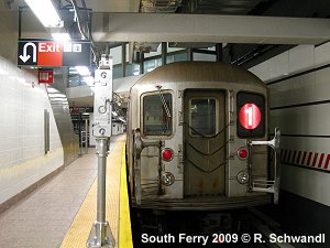


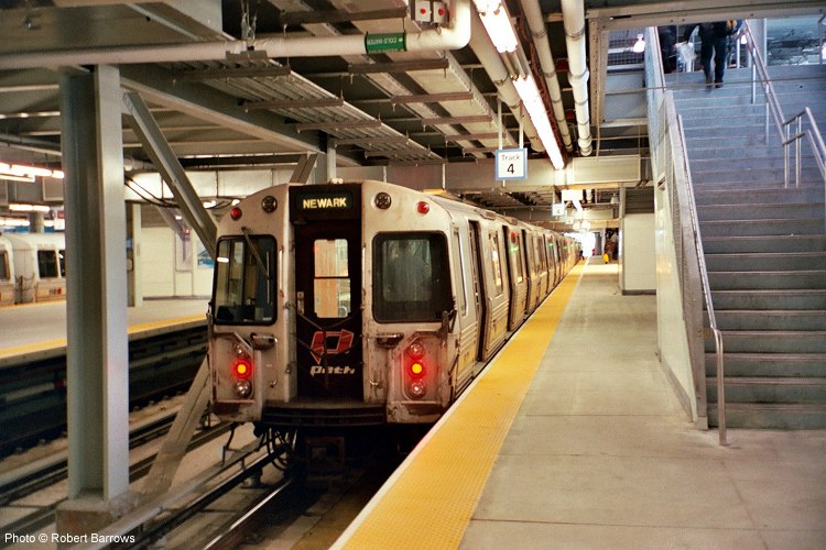
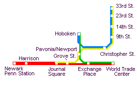 PATH
(Port Authority Trans-Hudson) links central Manhattan to Jersey City
and Newark in New Jersey: PATH operates like a metro (every few minutes
during rush hours), 24 hours a day. Opened in 1908, the total length
of the network is 22.2 km with 11.9 km underground (including two tunnel
routes under the Hudson River). The PATH system is operated by the Port
Authority of New York and New Jersey.
PATH
(Port Authority Trans-Hudson) links central Manhattan to Jersey City
and Newark in New Jersey: PATH operates like a metro (every few minutes
during rush hours), 24 hours a day. Opened in 1908, the total length
of the network is 22.2 km with 11.9 km underground (including two tunnel
routes under the Hudson River). The PATH system is operated by the Port
Authority of New York and New Jersey.