|
[ UrbanRail.Net ] [ Europe ] [ Americas ] [ Asia ] [ Africa ] [ Oceania ] [ News ] [ Books ] [ Links ] |
|
İSTANBUL
|
| Turkey |
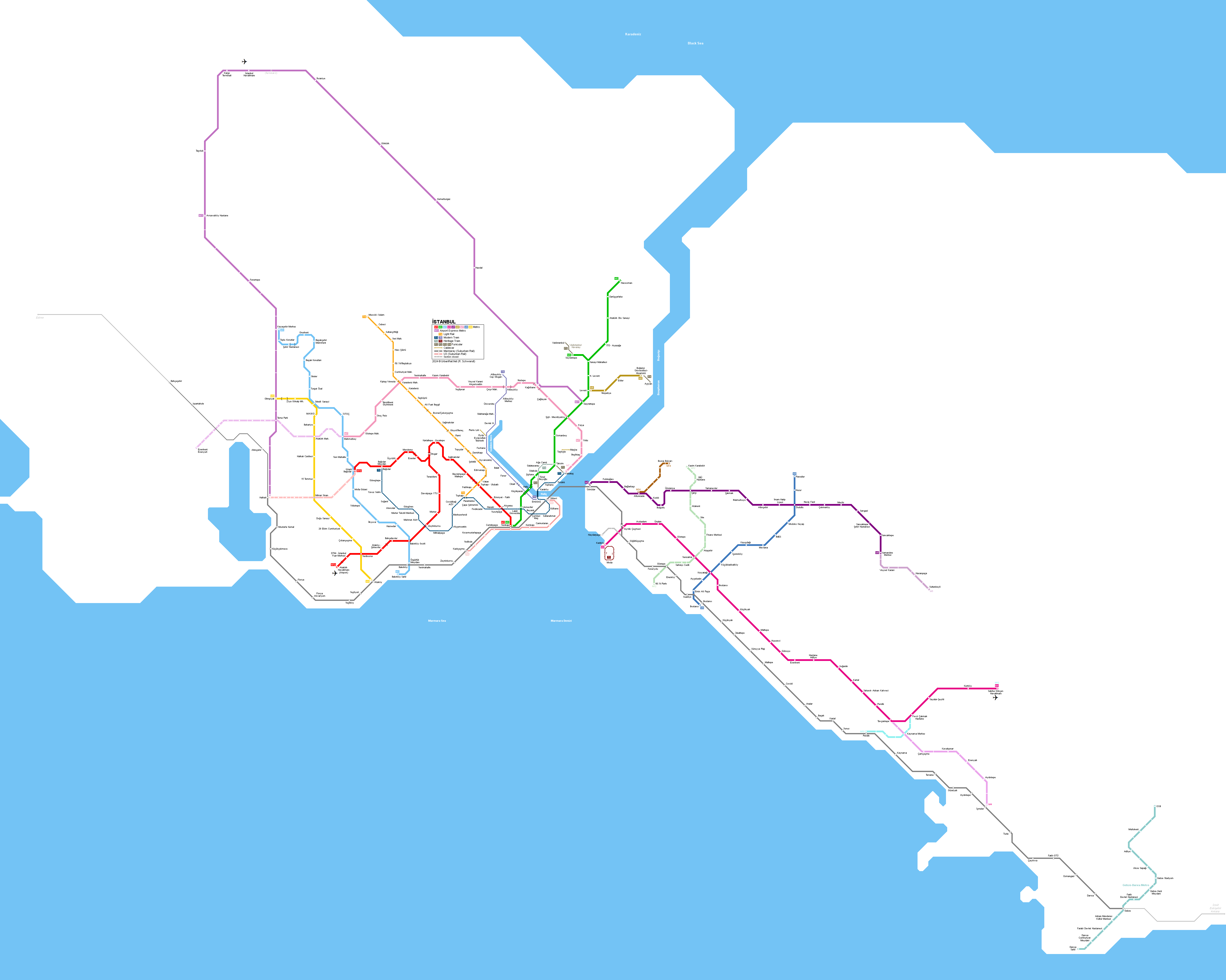
Click on map to expand to full size including Gebze!
|
[ UrbanRail.Net ] [ Europe ] [ Americas ] [ Asia ] [ Africa ] [ Oceania ] [ News ] [ Books ] [ Links ] |
|
İSTANBUL
|
| Turkey |
Click on map to expand to full size including Gebze!
| ISTANBUL | ||
|
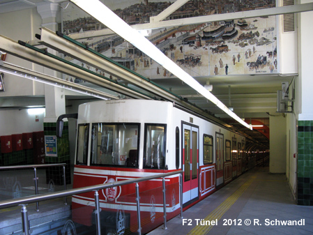
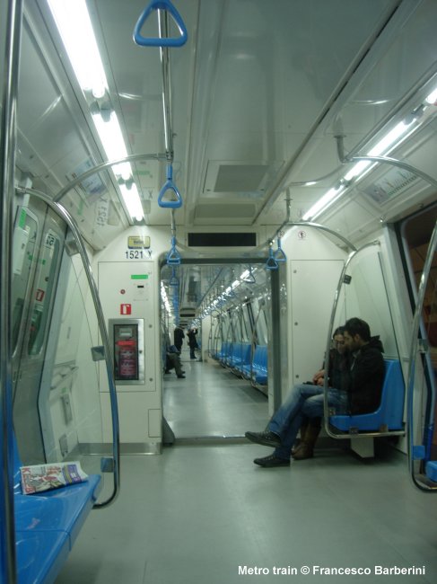
With approx. 15 million inhabitants in the metropolitan area, Istanbul is the biggest city in Turkey, mostly situated on the European continent. At the turn of the millennium, Istanbul had hardly any rail-based transport, but in the past decades, the city's urban rail system has been expanded massively, with more lines and extensions under construction or planned. The first underground line dates back to the 19th century. This is the funicular subway called "Tünel" which opened in 1875. Still today this short line (573 m) is an important means of urban transport as it surmounts a difference in altitude of 60 m. Trains operate every 3.5 minutes and a trip takes 1.5 minutes. The upper station is linked to Taksim Square by a vintage tram. In the 1990's also a modern tram line was put into service through the older parts of the city; this tram is gradually being extended to other parts of the city. In Oct 2013, the 13 km Bosphorus underwater rail link (Marmaray) opened, which will ultimately link the suburban rail lines operated by Turkish State Railways. Track gauge on all different rail systems is 1435 mm. |
||
| Metro M1 | ||
|
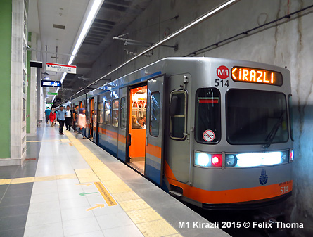
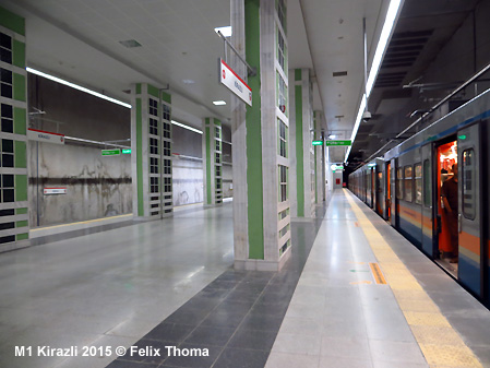
In 1989 a light metro line (Hafif Metro - M1) was opened from Aksaray towards the western suburbs. Until 1995 it was extended to Yenibosna. After reaching the airport (Havalimani station) in 2002, it had a total length of 20 km with 18 stops. The Esenler branch was eventually extended to Kirazli and became branch line M1b. The line is totally segregated from other traffic without level crossings and runs underground for several km (Aksaray - Ulubatli Topkapi, 3.1 km; Bakirköy - Bahçelievler, 1.8 km; Havalimani, 0.3 km; Esenler - Kirazli ~ 4.5 km). Platform length is 100 m. Yenikapi - Otogar: 8.4 km; Otogar - Havalimani: 11.6 km; Otogar - Kirazli: 5.5 km = 25.5 km 03
Sept 1989: Aksaray - Kartaltepe |
||
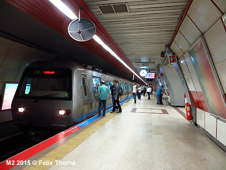
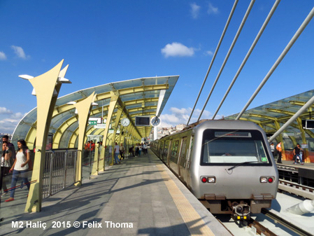
| Metro M2 | ||
|
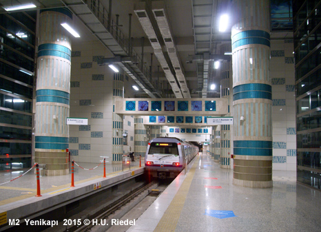
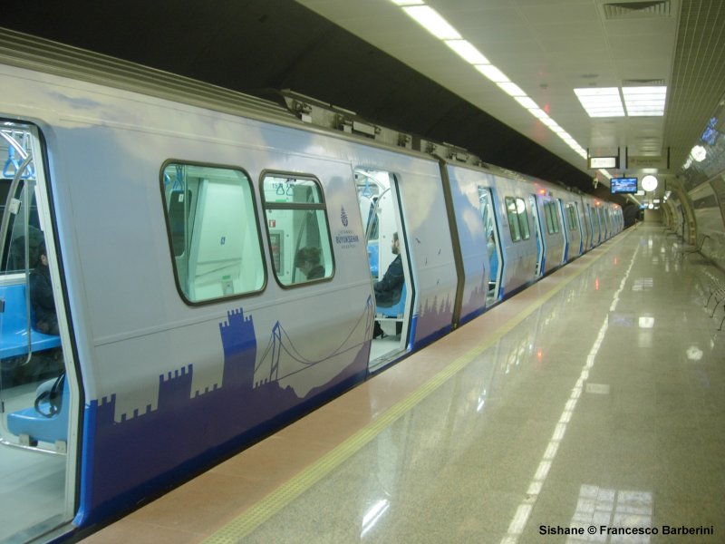
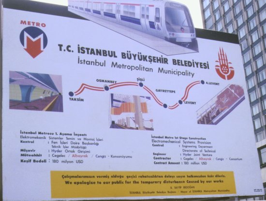
Construction of the first full metro line (M2) started in 1991 and the first section between Taksim and Levent opened after some delays in September 2000. All stations have escalators and an elevator to provide full accessibility for the disabled. The original section was built by the cut-and-cover method to withstand earthquakes up to magnitude 9. Stations look similar, although a different colour was chosen for each of them. Platform length is 180 m. Later, the line was extended in several stages northeast to Haciosman, while a 1-km branch from Sanayi to Seyrantepe was added in 2010, which primarily serves the new Galatasaray football stadium opened in 2011. The 1.6 km southwestern extension from Taksim to Sishane was initially operated as a shuttle service until the Yenikapi extension, which includes a purpose-built bridge over the Golden Horn (Haliç), was completed in 2014. Total length of the line M2 is 23.5 km with 16 stations (2014). 16
Sept 2000: Taksim - Levent |
||
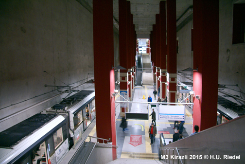
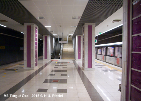
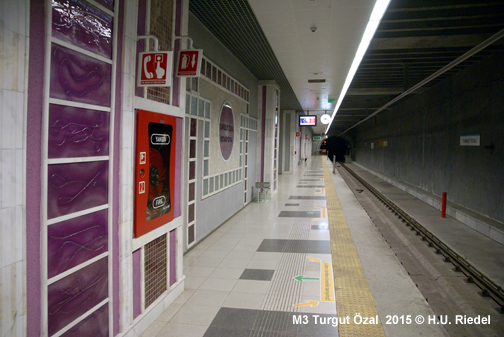
| Metro M3 | ||
|
14 June
2013: Kirazli - MetroKent (Basaksehir) - 25.8
km |
||
|
|
||
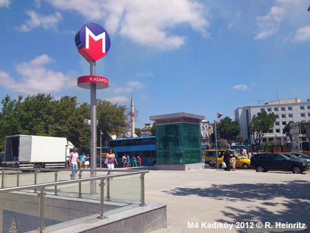
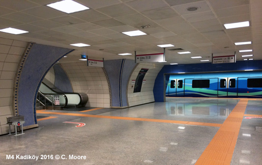
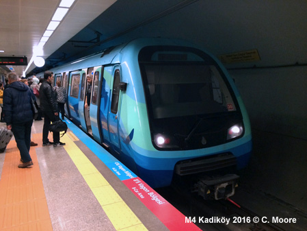
| Metro M4 | ||
|
First metro line on the Asian side of Istanbul, departing from the ferry terminal at Kadiköy and running fully underground south via Kartal to Sabiha Gökcen Airport: 17
Aug 2012: Kadiköy - Kartal (22
km) |
||
| Metro M5 | ||
|
- 26.5 km, driverless metro line on the Asian side of Istanbul, connects with Marmaray 15 Dec
2017: Üsküdar - Yamanevler (10.5 km) |
||
|
|
||
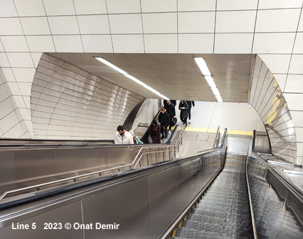
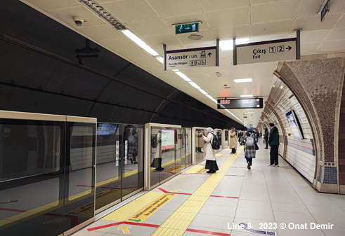
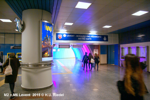
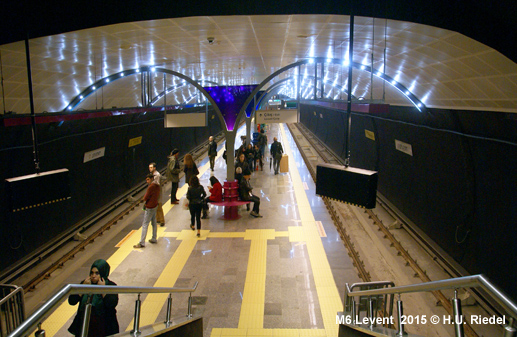
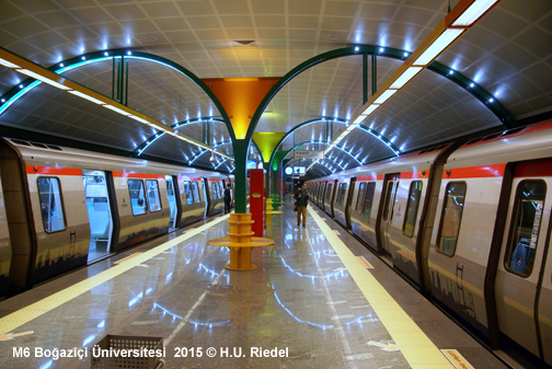
| Metro M6 | ||
|
19 April 2015: Levent - Bogazici Üniversitesi (Hisarüstü) - 3.3
km, basically single-track with passing loops at intermediate stations,
operated with two shuttle trains |
||
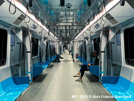
| Metro M7 | ||
|
28 Oct
2020: Mahmutbey Sisli-Mecidiyeköy - 19.2
km |
||
|
|
||
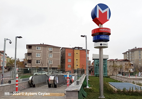
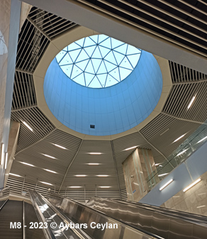
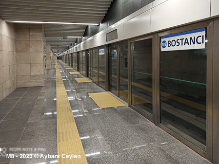
| Metro M8 | ||
|
06 Jan 2023: Bostanci Parseller - 14.3
km |
||
| Metro M9 | ||
|
22 Nov
2013: Olimpiyat Ikitelli Sanayi (as a branch of line M3) 17.2
km |
||
|
|
||
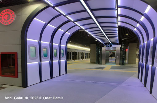
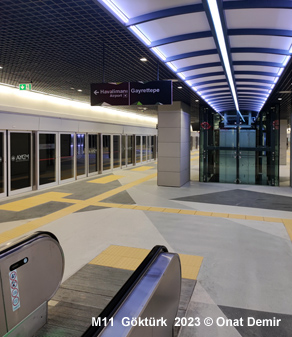
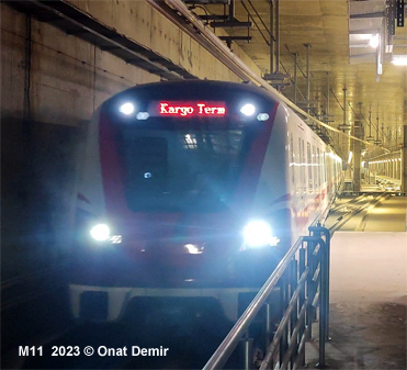
| Airport Express Metro - M11 (U1/U2) | ||
|
22 Jan
2023: Kagithane Kargo Terminali (34 km) |
||
|
|
||
|
||
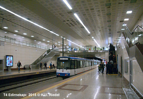
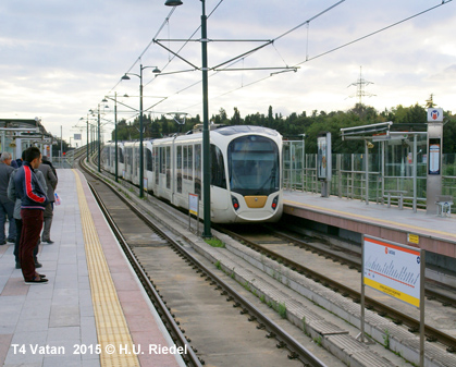
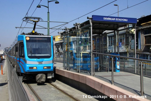
| Light Rail T4 | ||
|
This line was opened in 2007, running from the edge of the old city towards the northern suburbs. The line is referred to as the Sultançiftligi-Edirnekapi line, it was initially 12.4 km long (with 5.8 km underground) and has some level crossings. Although it is officially classified as a 'tramway' (T4), it uses the same rolling stock as Metro M1. A 2.3 km extension was added in 2009, providing transfer to line M1 and the tramway. 10
Sept 2007: Sehitlik
- Mescid-i Selam |
||
| Tram T1 | ||
|
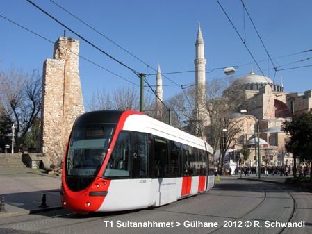
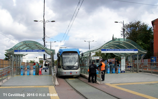
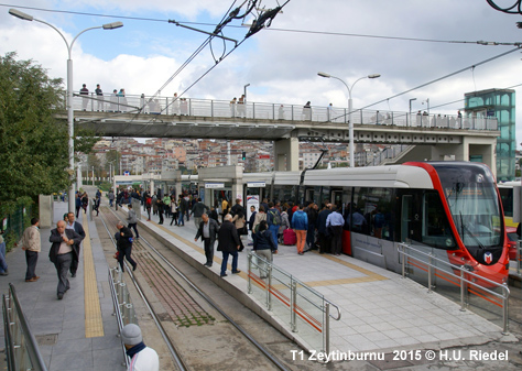
The present modern tram line T1 (18.2 km) was opened in 1992 between Sirkeci and Topkapi and subsequently extended from both ends. Temporarily operated with high-floor vehicles (like those in service on M1), it is now served by Bombardier Flexity Swift low-floor trams. Line T2, which had opened in September 2006 from Zeytinburnu to Bagcilar, was connected to T1 in early 2011, and the single line is operated with low-floor vehicles, both from Bombardier and Alstom (Citadis). |
||
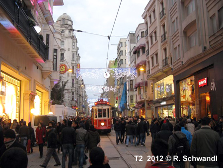
| Tram T2 | ||
|
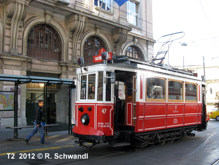
Line T2 is the heritage tram line (1.5 km) which connects the top station of the Tünel Funicular to Taksim Square; opened in 1990, single-track.
|
||
|
|
||
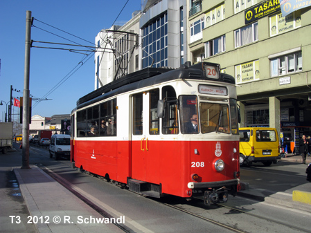
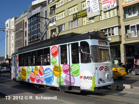
| Tram T3 | ||
|
Nostalgic Moda tramway opened in 2003: single-track 2.6 km circular line on the Asian side of Istanbul in Kadiköy. Trams run in a clockwise direction stopping at Kadiköy (ferry and M4) - Iskele Camii - Çarsi - Altiyol - Bahariye - Kilise - Moda Ilkokulu - Moda - Rizapasa - Mühürdar - Damga Sokak before returning to Kadiköy. |
||
|
|
||
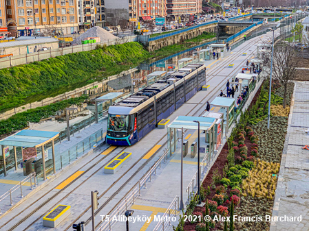
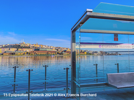
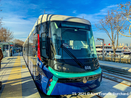
| Tram T5 | ||
|
Modern tram line along the Golden Horn north to Alibeyköy using Alstoms APS ground-power-supply system like in Bordeaux; at the southern end, interchange with the older tram T1 at Eminönü: 01 Jan
2021 Cibali Alibeyköy Cep Otogari (9 km): official inauguration,
passenger service from 04 Jan 2021
|
||
|
|
||
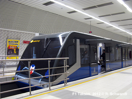
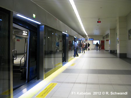
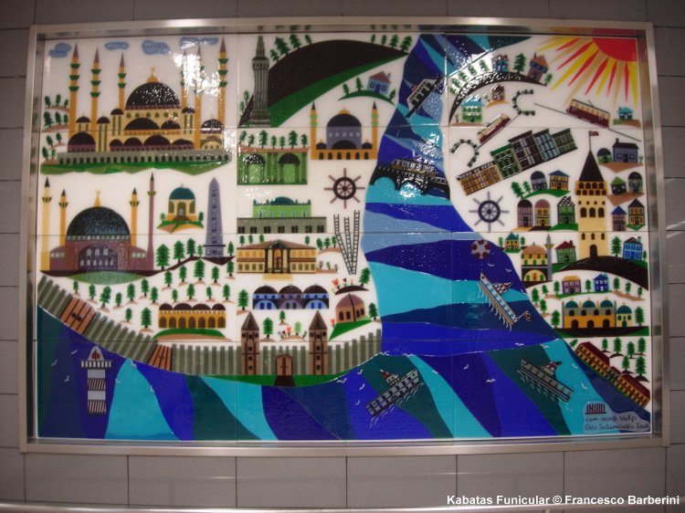
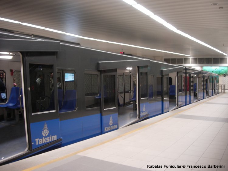
| F1 Taksim - Kabatas Füniküler | ||
|
Modern funicular subway opened in June 2006: about 600 m long, difference in altitude of 60 m.
|
||
|
|
||
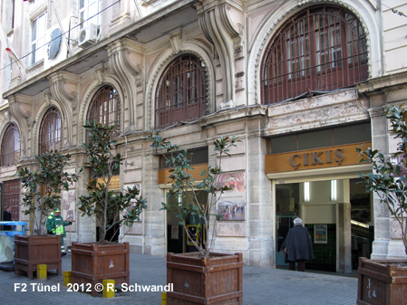
| F2 Tünel | ||
|
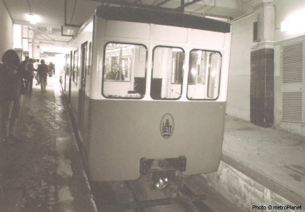
Funicular subway opened in 1875: on its 573 m route it negotiates a difference in altitude of 60 m.
|
||
|
|
||
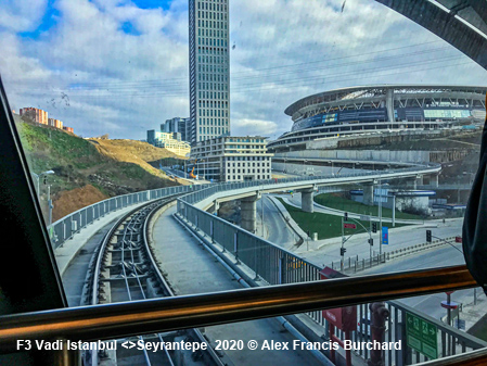
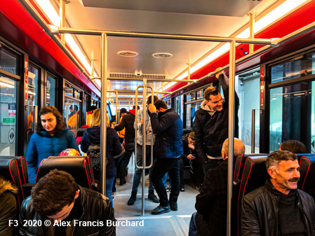
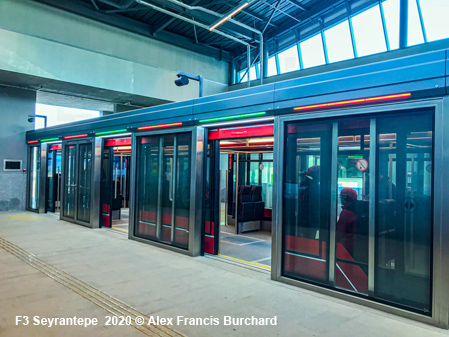
| F3 Vadistanbul Havaray | ||
|
A 750 m peoplemover was opened in 2019 to link the new development of Vadistanbul to metro station Seyrantepe (M2). [Wiki]
|
||
 |
||
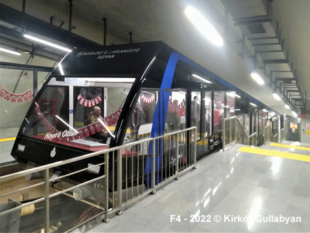
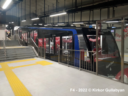
| F4 Bogaziçi Üniversitesi/Hisarüstü-Asiyan Füniküler | ||
|
A 800 m funicular was opened on 28 Oct 2022 to link the Bosphorus shore with the university area and metro line M6 above [Wiki]
|
||
|
||
|
|
||
| Marmaray - Suburban Rail | ||
|
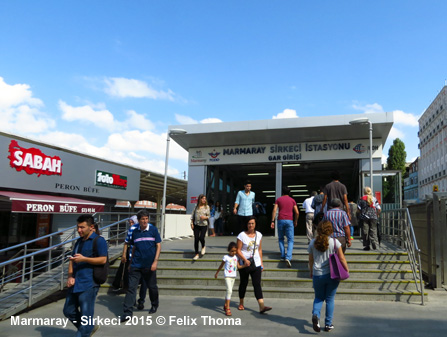
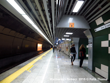
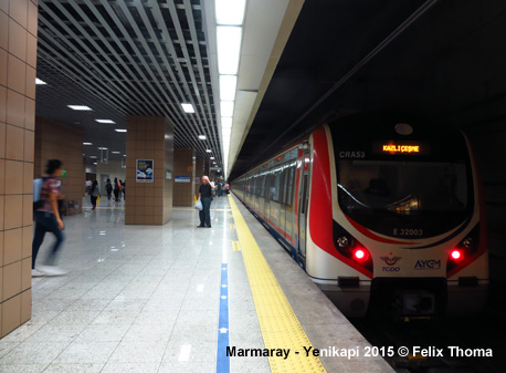
On 29 Oct 2013, the long planned underwater Bosphorus rail crossing, referred to as 'Marmaray', the construction of which had started in May 2004, was opened. The project includes a 13.3 km Istanbul Strait crossing and the upgrade of 63 km of suburban lines to create a 76.6 km high capacity line between Gebze and Halkali. The Istanbul Strait crossing was realised by means of a 1.8 km earthquake-proof immersed tube tunnel, assembled from 18 sections. This underwater tunnel is linked to bored tunnels from Kazliçesme on the European side and Ayrilik Çesmesi on the Asian side of Istanbul. Intermediate underground stations were built at Yenikapi, Sirkeci and Üsküdar (Sirkeci only opened on 1 Dec 2013). The Yenikapi hub includes the termini for metro lines M1 and M2. The upgrade of the suburban lines required the laying of a third track along most of the way to increase the line capacity. The automatic train control system provided by Siemens (Trainguard Sirius) allows a train every 2 minutes. After a 6-year closure, the upgraded existing suburban rail lines, one on the European side (Sirkeci - Halkali, 27.5 km; Kazliçesme - Halkali incorporated into new line), and one on the Asian side (Hayderpasa - Gebze, 44 km; Sögütlüçesme - Gebze incorporated into new line) was eventually reopened on 12 March 2019 after being linked to the Marmaray tunnel (Line B1 Halkali - Gebze). The intercontinental rail tunnel is also used by long-distance trains. A limited shuttle service was launched on 23 May 2022 on a single-track line between Halkali and Bahçesehir (Line B2). On 26 Feb 2024, the historic approach line along the seashore to Sirkeci railway station reopened with a new shuttle service between Sirkeci and Kazliçesme (labelled 'U3'). [Project Website] [Video]
|
||
|
Projects |
||
|
Under construction (updated March 2024): M1B: Kirazli - Halkali extension M4: from Tavsantepe (formerly known as Kaynarca) a branch to Tuzla (Icmeler) M5: eastern extension Samandira Merkez - Sultanbeyli M7: eastern extension Yildiz - Kabatas (2024); western extension from Mahmutbey to Esenyurt Meydani M10: from Pendik to Istanbul-Sabiha Gökçen International Airport, partly shared service with M4 M11: completion of western leg of Airport express line from Halkali to Arnavutköy Hastane M12: Cross-city line on Asian side from Kazim Karabekir to 60. Yil Parki (Ümraniye - Atasehir - Göztepe Metrosu; 13 km) (Project Website) M13: Yenidogan-Emek Metro on Anatolian side - project updated in 2024 with a longer route reaching Sögütlüçesme) M14: Altunizade - Bosna Bulvari Gebze-Darica Metro (15.6 km) has been under construction since late 2018 in the southeastern corner of the Istanbul metropolitan area > see our dedicated page here!
|
||
| Links | ||
|
Metro Istanbul (Official Website) IETT - Tünel and Tram Operator Istanbul Metropolitan Municipality > Transportation Funimag > Tünel Istanbul Metro at Wikipedia Marmaray at Wikipedia Ray Haber (Turkish Rail News)
|
||
| Photos | ||

Photos 1-4 © Francesco Barberini; 5 © Burç Acar; 6 © K.Gullabyan |
||
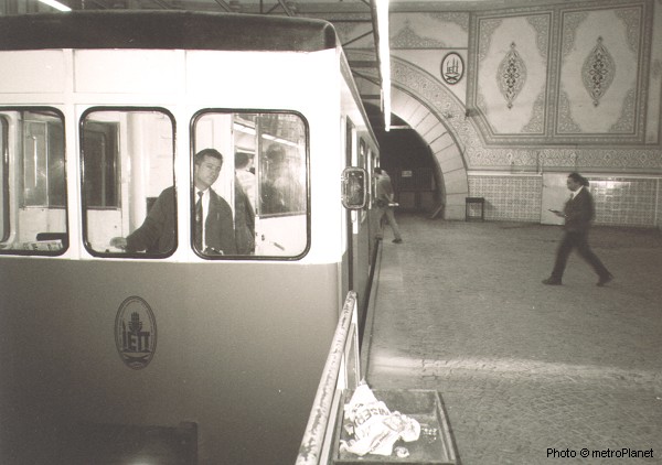
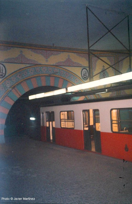
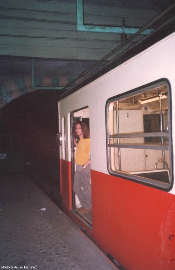
Tünel photos thanks to Christian Fuchs and Javier Martínez Cuevas!
2004 © UrbanRail.Net by Robert Schwandl.