[ UrbanRail.Net ]     [ Europe ] [ Americas ] [ Asia ] [ Africa ] [ Oceania ]     [ News ] [ Books ] [ Links ] [ Blog ]
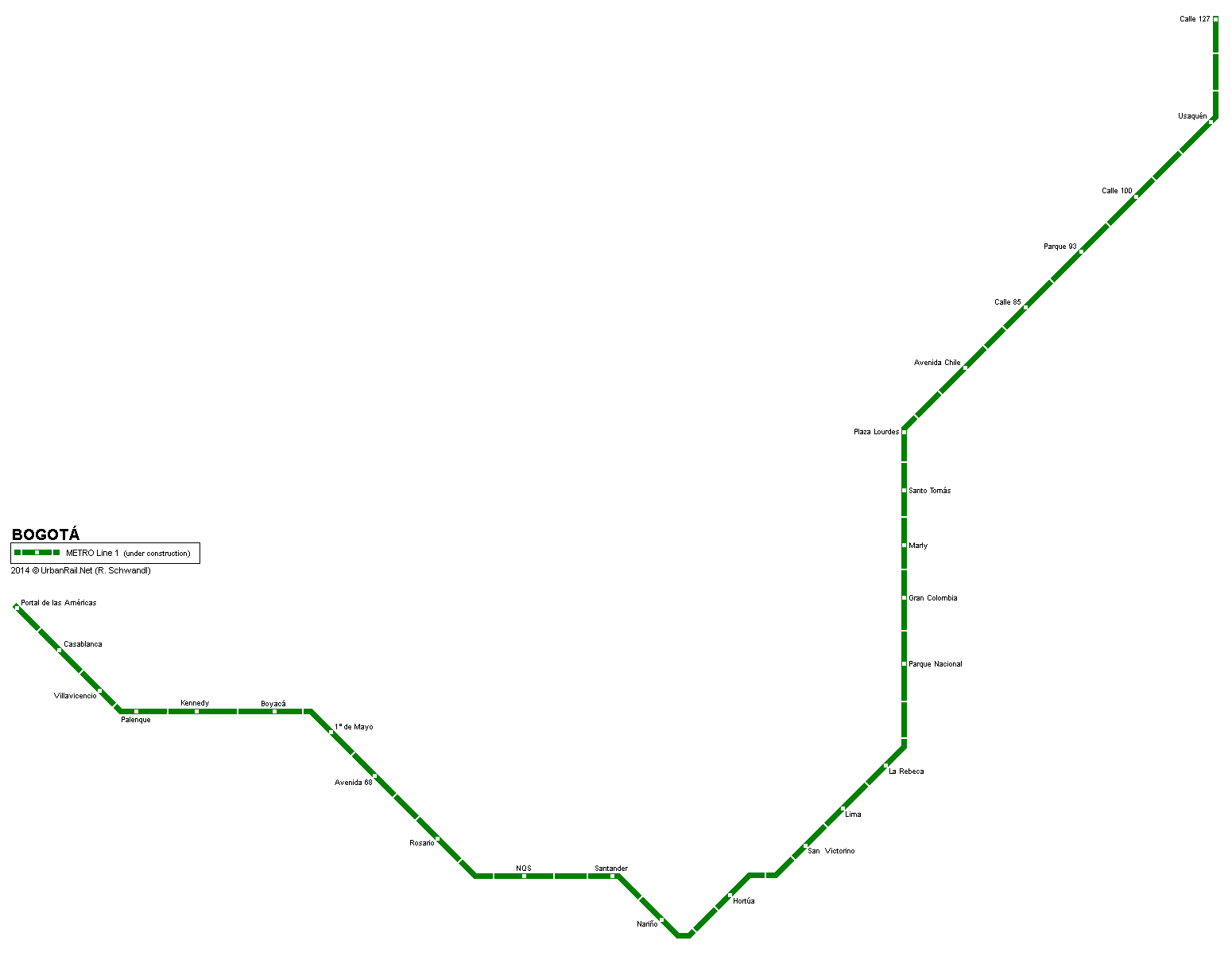
BOGOTÁ
 Colombia

Bogotá metro map

 System

Bogotá, capital city of Colombia, some 7.6 million inhabitants


 History


 Projects

Line 1 - 26.5 km, 28 stations, running from El Tintal (workshops), Portal de Las Américas, along Avenida Villavicencio and Avenida Primero de Mayo, and then either along Primero de Mayo or Avenida Primera (Hortúa); the line will reach the city centre via Carrera 13, then join San Victorino, and from the intersection Calle 13/Carrera 13 it turns north to Parque Lourdes, getting aligned along Carrera 11 past el Cantón, then along Carrera 11B and finally Carrera 9 before reaching Calle 127.

The first line is scheduled to open in 2018/19.

 Photos
 
 Links

Metro de Bogotá - Official Site

Metro de Bogotá at Wikipedia.es


 Photos


MAIL

2013 © Robert Schwandl (UrbanRail.Net)