|
[ UrbanRail.Net ] [ Europe ] [ Americas ] [ Asia ] [ Africa ] [ Oceania ] [ News ] [ Books ] [ Links ] |
|
CHENNAI
|
| Tamil Nadu . India |
|
[ UrbanRail.Net ] [ Europe ] [ Americas ] [ Asia ] [ Africa ] [ Oceania ] [ News ] [ Books ] [ Links ] |
|
CHENNAI
|
| Tamil Nadu . India |
| CHENNAI | |
|
Chennai, formerly called Madras, is the capital of the state of Tamil Nadu in southeastern India. The city has some 5 million inhabitants (7.5 mill. in metropolitan area). Chennai has quite a robust urban rail network based on three different systems. The backbone of this network is Southern Railways (SR) suburban network of 3 lines which has attempted to generate a genuine corporate-urban rail atmosphere; the single line MRTS which, although operated by SR, used to be segregated from other suburban services, but now offers through trains to other lines; and finally, the new Chennai Metro. Together there are 240km of rail service within the city boundaries, hosting 105 stations.
|
|
| Metro Rail (CMRL) | |
|
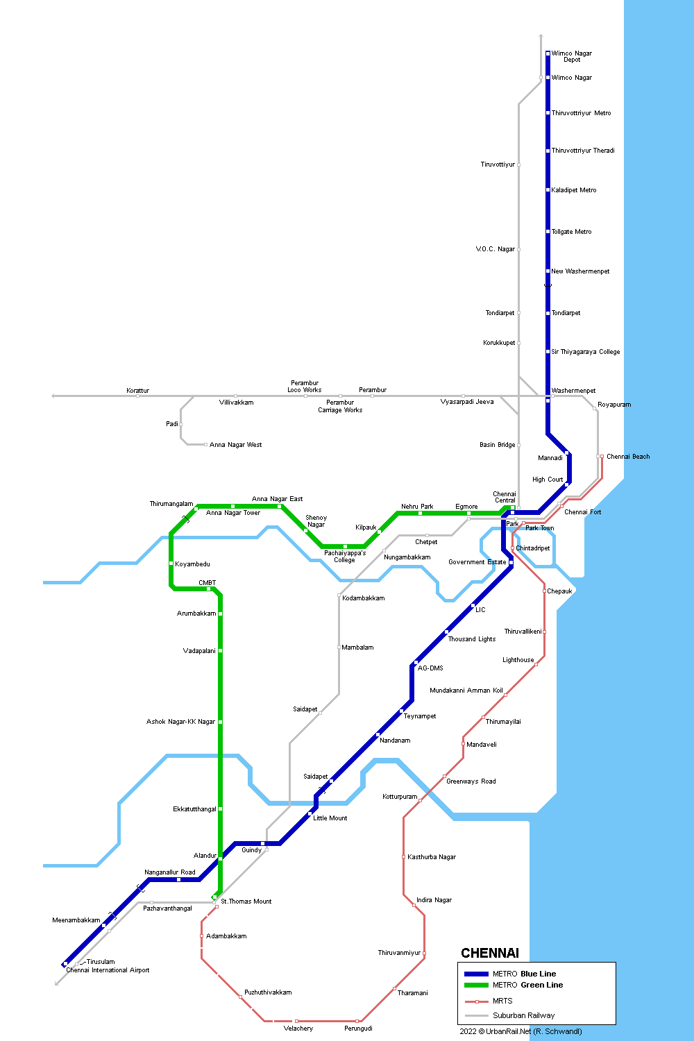
Chennai is building a 2-line metro network. Phase-1 of the 'Chennai Metro Rail Project' consists of two corridors with a combined length of 45 km. Corridor-I, with a length of 23.1 km (14.3 km underground and 8.8 km elevated), will run from Washermenpet to the Airport via Anna Salai (Blue Line). Corridor-II, with a length of 22 km (9.7 km underground and 12.3 km elevated), will run from Chennai Central to St. Thomas Mount via Koyambedu (Green Line). The portions of Corridor-I from Washermenpet to Saidapet on Anna Salai, and Corridor-II on Periyar EVR Salai and Anna Nagar 2nd Avenue, will be underground and the remainder elevated. Construction on the elevated section on Corridor-II between Thirumangalam and Ashok Nagar began in June 2009. The first 10 km elevated segment of the Green Line opened on 29 June 2015, the first 8.6 km section of the Blue Line on 21 Sept 2016. Still part of phase 1, the Blue Line was extended north to Wimco Nagar in Feb 2021. Metro
History: For details click here (Wikipedia) |
|
 |
|
| Report | |
|
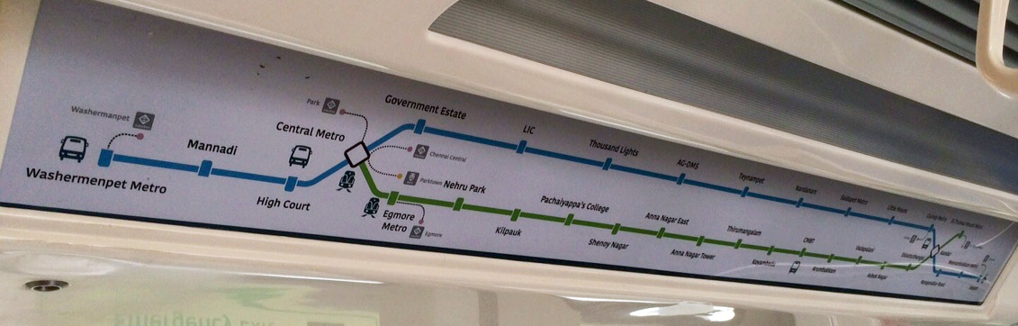
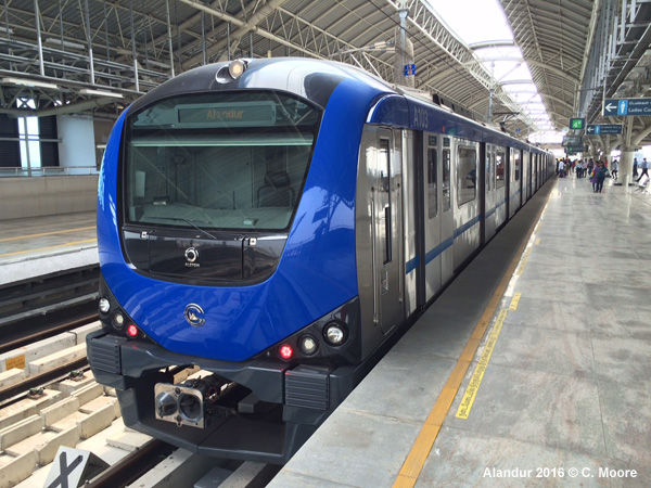
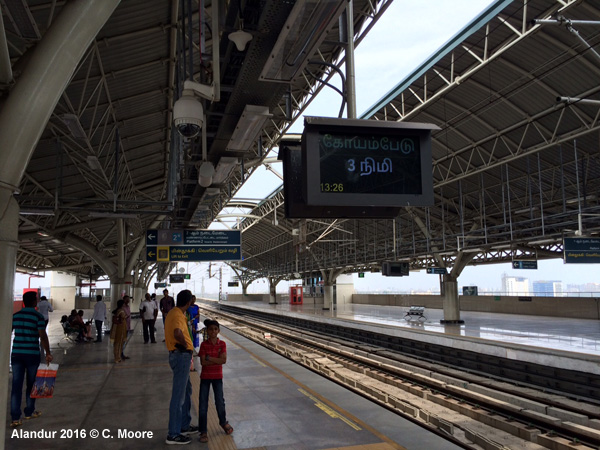
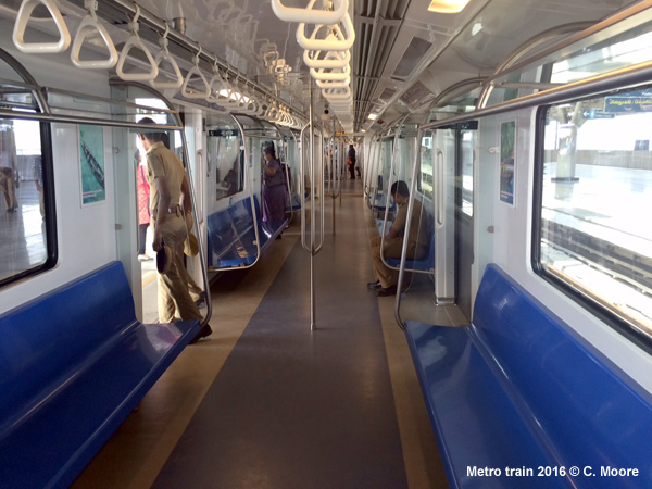
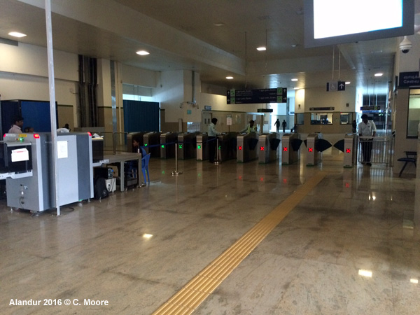
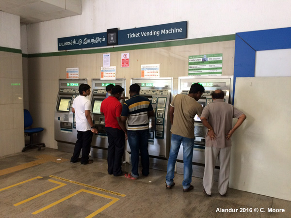
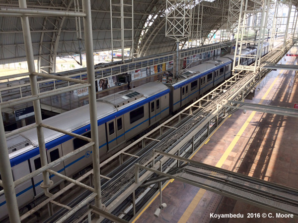
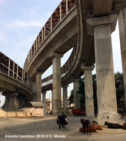
Craig Moore reports from Chennai in Nov 2017: The Chennai Metro opened in 2015 with a 10km (7 stations) elevated north-south stretch in the west of the city between Koyambedu and Alandur and has since been extended to the Airport, St Thomas Mount (transfer to suburban rail services) and to Nehru Park in the east. The current 2-line offer has both elevated and underground alignments and is 27.9km (7.0km underground) with 20 stations (7 underground). The system uses 1435 gauge and has overhead catenary power supply. The Airport station is located between the international and domestic terminals and is not physically connected to either terminal building. Signage is pretty poor also and you have to leave the terminal to search for the hand-painted signs for <- Metro located on the terminal support pillars. Crossing a road and climbing stairs takes you to a cross bridge and access to the Metro ticket hall. The structure itself is large and modern with side platforms on the upper level. Services depart from alternate platforms. The section to Nanganallur Road is elevated with lovely views of historic St Thomas Mount (religious pilgrimage site) before arriving from the south to Alandur with its wonderful multi-level infrastructure (see below and photo). Blue Line services arrive at the lower-level platforms and head northeast to Little Mount (total 8.6km) whilst the Green Line services to St Thomas Mount and Nehru Park operate from the high-level platforms. Because of its elevated nature the line is prominent in the cityscape and the stations are huge. The entrance halls offer ticket counters, ticket machines (only certain note denominations and everyone queues at the ticket office anyway) and a customer office , although there is no hard-copy information or maps available. There is, however, a smart information board with, I would proffer, the most stylish rail map on the sub-continent. This shows the full metro network, and MRTS/suburban lines with interchange. The only timetable information available is on television screens offering next train times. Entrance to the system is via electronic gates where the small blue token is scanned on entry. Escalators or stairs lead you to the platform level which can host 6-car sets, although only 4-car sets are used at the moment. These areas are also light and airy due to high canopied roofing. The platforms have smart signage and audio/electronic next train information. On the older part of the system the signs are in three languages (English, Tamil, Sanskrit) but the newer extensions have dropped Sanskrit and just have English-Tamil directional and station signage. All elevated stations have side platforms and each platform employs a lady with whistle to ensure people stay behind the tactile yellow line and also to assist in train departure. The elevated Green Line (total 19.3km) north of Alandur undulates at times and offers some interesting views of western Chennai. The line here provides access to the large shopping mall at Vadapalani and the equally-sized CMBT bus station. At Koyambedu, flying junctions to the west provide access to the large shedding facilities and the Metro Operations Centre. The line then turns east and the train runs very slowly and screechily down the ramp to the 7.0km underground section. The underground stations have a clean, modern feel with bright ticket halls and stairs, escalators and lifts to the island platforms with large tinted tiling throughout. These platforms have signs with just two languages, full screens and nice strip map above, seating and RTI. A very nice addition to the system. Current services run between 0600 and 2200 and have a base headway of 20mins per line, although an inter-corridor service has been created to double the frequency on the sections where most patronage exists. And so the Blue Line has a 20min headway from the Airport to Little Mount, whilst the Green Line also runs from Shenoy Nagar to St Thomas Mount 3 times per hour. But these services are supplemented by the inter-corridor service from Nehru Park to the Airport, dovetailing schedules with both lines to provide 10min headways between Shenoy Nagar Alandur - Airport. This interconnectivity of services is made possible by the dual-level infrastructure at Alandur where the lower-level platforms serve the Blue Line and the higher-level platforms serve the Green Line, but at the southern end of the station there are ramps connecting the north-south line (Green Line) to the airport branch (Blue Line). This is very impressive to look at and scheduling is kept tight to provide passengers on either line, and in either direction, with appropriate connections. The 4-car Alstom stock is air-conditioned, clean and bright with a mainly white interior and blue side seating (each train has one carriage reserved for women only). There is stylised strip maps in English and Tamil. The map is future-proofed showing the completed system, interchange with suburban rail/MRTS and the Indian roundel icon. Originally, the line was not well patronised but has grown its passenger numbers since the extensions to the system and will likely grow further once the system connects with other rail services in the city. However, the system is still not crammed with passengers as in Kolkata or Delhi. Partly this must be due to the high fares charged which are distance-based (10-60 rupees) ( 0.08- 0.80) - this may seem inexpensive, but the suburban rail (see below) costs just 5 Rupees for 20km of service. The Chennai Metro is not used by the majority of the city s populace! In summary, this system is a stylish addition to the Indian metro family with a strong brand identity, smart scheduling, and good coverage of main trip-generating points services. It will be a great asset to Chennai once completed and with interchange with the other urban rail services in the city. |
|
|
|
|
| Mass Rapid Transit System (MRTS) | |
|
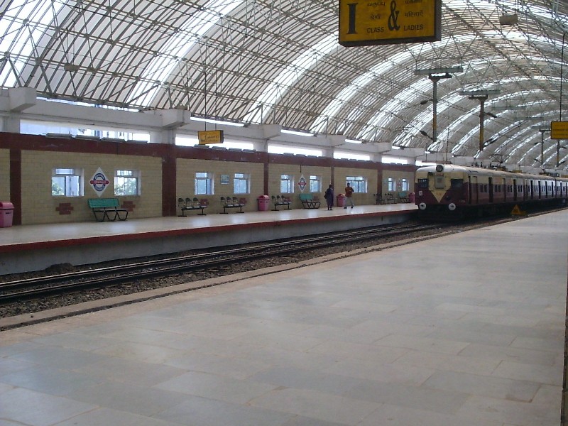
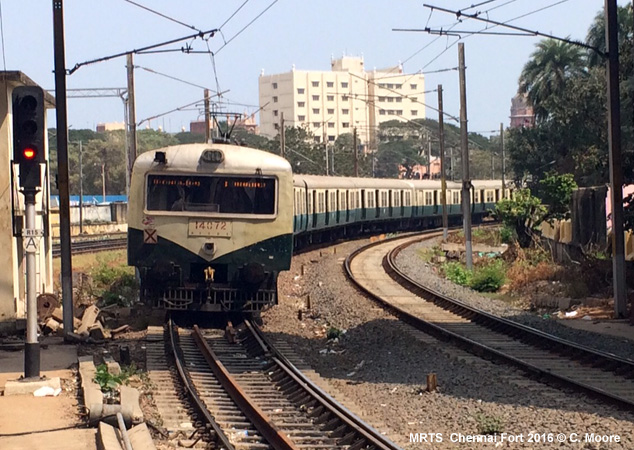
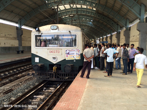
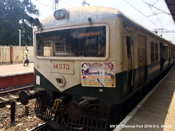
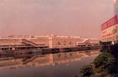
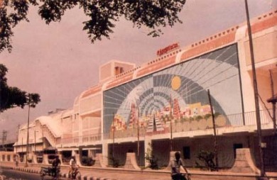
The first phase of the Mass Rapid Transit System (MRTS) from Beach to Thirumayilai opened on 19 Oct. 1997. This was a 9 km long surface line with 8 stations and runs mostly along the Buckingham Canal. 6 km (5 stations) of the line are elevated. After several extensions, the MRTS reached a total length of 24 km. The MRTS is not a proper metro line, but part of Chennai's well-patronized suburban rail network (1676 mm broad gauge), which includes several other lines: a. Beach to Tambaram (30 km, 18 stations): This section is parallel to but completely separate from the long-distance tracks of Indian Railways. The Trisulam station on this line is 100m from the Chennai International Airport terminal. This line first opened as an electrified suburban rail line in 1930 (originally 1000 mm gauge). b. Chennai Central to Pattabiram (25 km, 15 stations) This section is again parallel to but completely separate from long-distance tracks. Services run for a further 34km (14 stations) on this line on tracks shared with long-distance tracks. Services first began on this line in 1985. A separate pair of tracks was added from Pattabiram to Tiruvallur (17km, 5 stations) on 19 Sept 2004. c. Chennai Central - Gummidipundi (48km, 16 stations) - This line currently shares tracks with long-distance trains but there are plans to build exclusive tracks in the future. Services have been running on this line since 1985. MRTS
History:
|
|
|
|
|
| Report | |
|
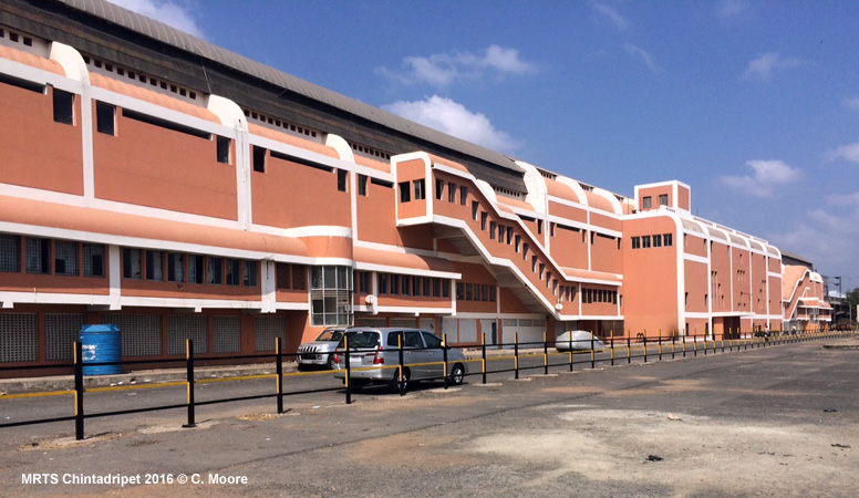
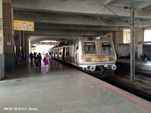
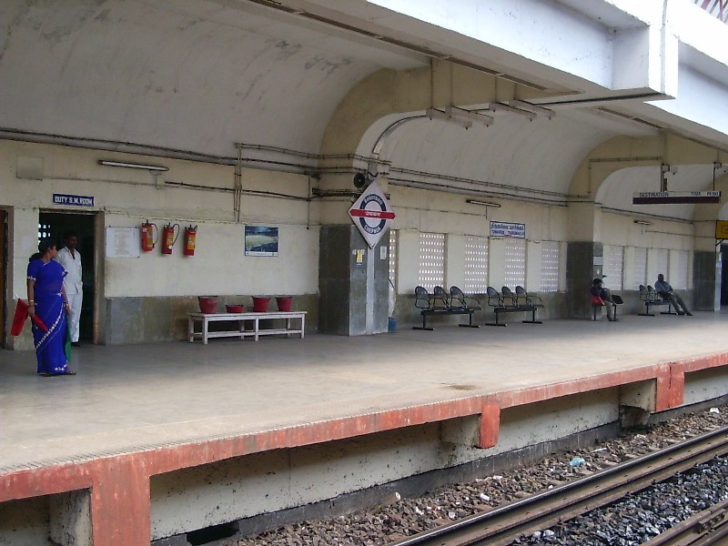
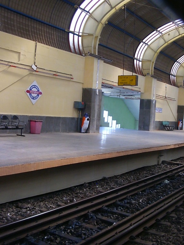
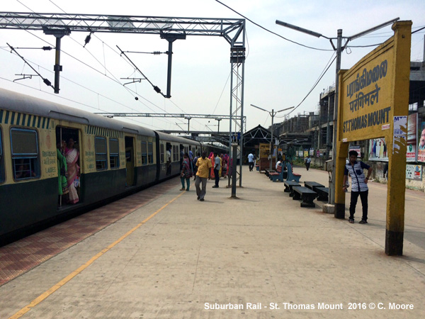
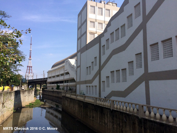
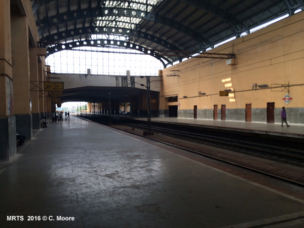
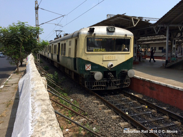
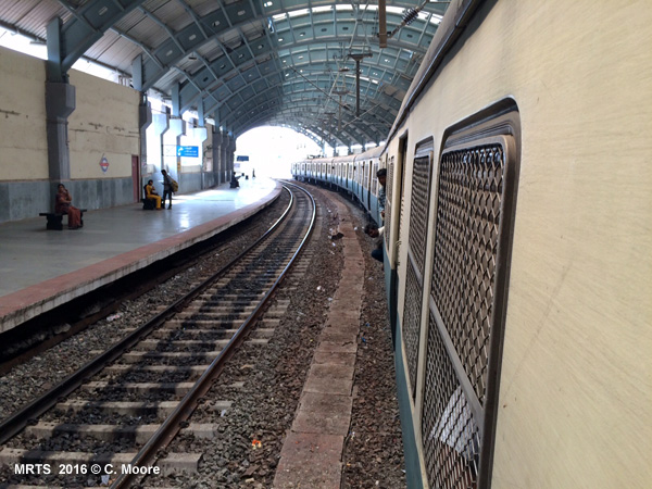
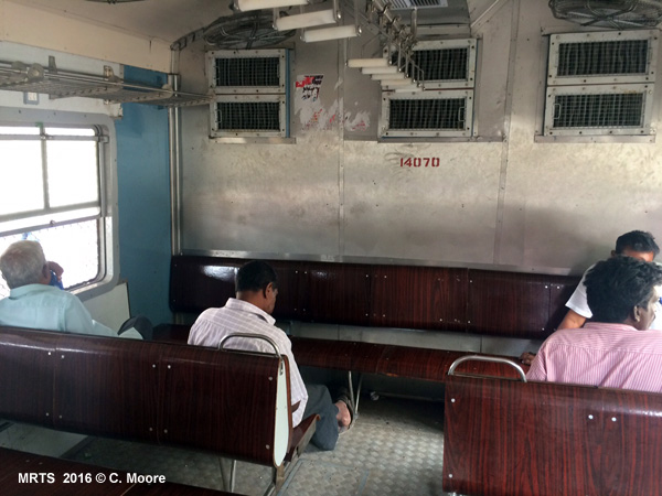
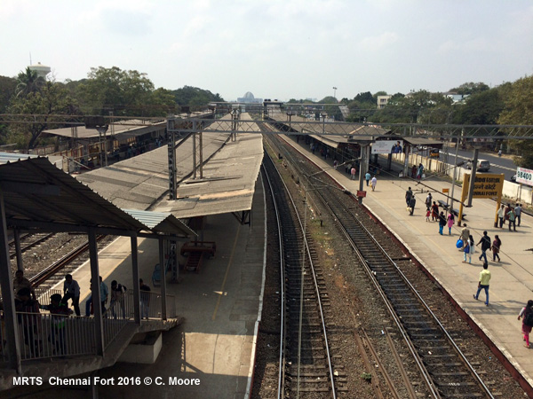
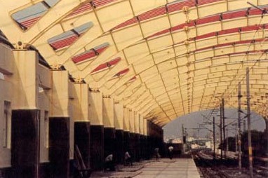
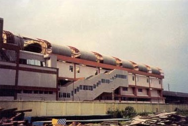
Craig Moore reports from Chennai in Feb 2016: I feel the MRTS is a good example of transport planners and government officials getting things very wrong, despite their best intentions. Theoretically, the development of the MRTS ticked all the boxes (a much needed north-south link in the city centre, major trip generation points (e.g. the Cricket Ground), expansion of the line to new IT industrial areas, and elevation to minimise forced land acquisition), yet in practice, it has not succeeded. The line runs from Chennai Beach, north of the city centre, in a south westerly direction to Velachery for 19.3km (18 stations) with a totally journey time of 47mins. The first 2.7km of the line are at grade and run parallel to the existing metre-gauge Chennai suburban South Line. Here the trains crawl at a very slow pace. After Park Town the line becomes elevated and the speed increases as trains cross the Choovam River to the principal and substantial stations of Chintadripet and Chepauk, from where there are lovely views of Chennai Beach and the Bay of Bengal beyond. For the most part, the line runs 14m above and alongside the rather decrepit Buckingham Canal. Beyond Thirumayilai the line turns westward and it is only before the southern terminus of Velachery that the line returns to grade. From here an elevated extension is in construction to St Thomas Mount. The centrally located grade stations are very basic and of typical Indian style, whilst the elevated stations must be some of the most overbuilt urban rail monoliths in existence. There is no danger of not being aware of the MRTS, not because of any street signage, but because of the scale and ugliness of the infrastructure. Station entrances are tucked away at the sides of the stations and not near the main road junctions crossed by the station. These more appropriate entrances have been closed for security reasons. The ground floor is dark, with numerous broad pillars supporting the structure, located across the vast space. At ground level there is a small ticket office hidden in the darkness, and stair or rusted escalator access to an intermediate floor (which is home to a large stray dog population, litter and crumbling concrete). Further stairs provide access to the platform level. The platforms themselves (all side platforms) are long and empty with defective next train indicators and a small schedule poster hidden well down the platform (and not accurate). The platforms are topped by huge canopied roofs of different styles. Each station has the wonderful Indian roundel, but no useful information or system maps. The overall footprint of stations is massive and these huge spaces could be used by vendors etc. but there is simply nothing but empty cavernous unkemptness. Added to this is the weathered feel of the stations. They are very decayed and even the recently renovated stations at Chintadripet and Chepauk don t look that smart. Services run from 0430 to 2300 with a base headway of 15/20mins. Services use locally produced ICF 9 car sets (5+4). There are first-class and women-only carriages, although first class is used by anyone. The stock is very tatty and uses airline seating, although this is segmented into two compartments within each carriage, split by a barriered dead space, and so you cannot walk through an entire carriage. The line uses Indian broad gauge (1676) and trains use overhead power supply. Tickets cost 5 Rupee ( 0.07) for a single journey on the MRTS. Tickets are in paper form, printed out on an individual basis with departure and arrival station. However, this is a completely open system and there are no barriers or ticket checks and most people just seem to hop on and hop off without tickets. The trains have audio and electronic announcements on the trains in Hindi, Tamil and English (the audio is difficult to hear over the noise of the ceiling fans in the carriages and the fact that doors are permanently open). This was a line I was looking forward to and, in truth, I was a little disappointed. The relatively long headways and lack of discrete branding undermines the notion that this is a genuine urban rail line, and it is certainly more suburban rail than metro. The lack of service intensity is one of the reasons why the MRTS has not delivered the patronage originally hoped for, and you realise this once you ride the characterful and busy Chennai Suburban Rail system. Unlike many other cities on the sub-continent, SR have made a genuine attempt to create a brand for Chennai s suburban rail network. The network has 3 lines and stretches for 585km, although 211km (80 stations) exist within the city/urban area. Services operate from 0400 to midnight and run on 1000 (south line) and 1676 mm (west/north lines) gauges and use similar stock to the MRTS, with overhead power supply. The south line to Tambaran is the most intensive of the three lines with average 10min frequencies outside of peak (although times are irregular). The lines are double-tracked, with regional and long-distance services on parallel lines, utilising the same stations, but with shorter platforms, separate from the suburban service platforms. The suburban rail patronage is very high, trains are crowded with many passengers clinging to the outside around the doors, and the central stations, along with the main suburban stations, have a real buzz. Automatic ticket machines are available and show an interesting schematic map, but most passengers appear to queue at the ticket offices, as has been tradition. Fares are distance-based and cost between 5 and 20 rupees. (20 rupees ( 0.26) will get you 100km!!). Stations are all at grade and are very basic but have the wonderful roundel as well as huge yellow and black station signs. St. Thomas Mount will become a transport hub once all construction is completed and in addition to the suburban services, there will be MRTS and Metro services. Both of these will have physical connection to the current station but will be elevated. It will be an interesting area to visit in the next few years, as will the city as a whole, as the current construction of urban rail across the city moves toward completion. A nice city, with a wonderful rail environment, which will only improve in coming years. |
|
| Links | |
|
Chennai Metro Rail Ltd (Official Website) Southern Railways - MRTS Operator Chennai Metro at Wikipedia Chennai Suburban Railway at Wikipedia Map showing suburban and mass transit lines provided by Hannes Neugebauer Chennai Metro Projects (TheMetroRailGuy)
|
|
|
Photos |
|
|
|
|
Photos © Sridhar Narayanan |
|
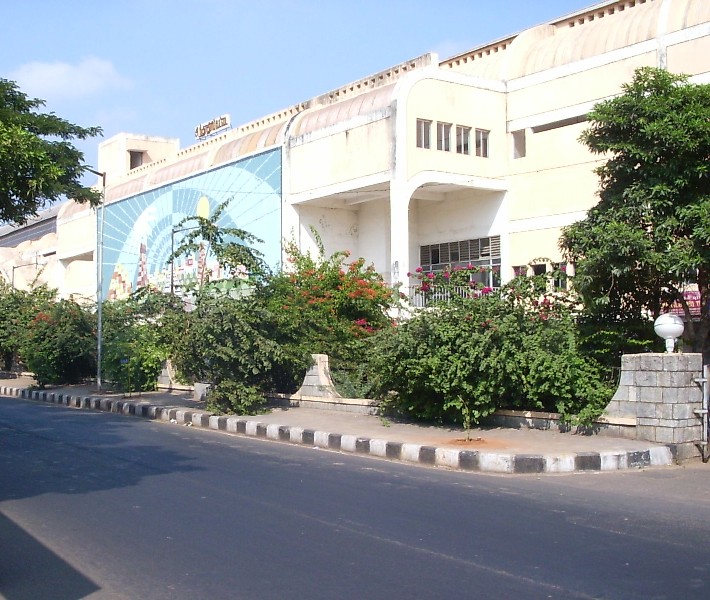
 Left: Chintadripet - Right: Light House |
Thanks to Sridhar Narayanan!
2004 © UrbanRail.Net by Robert Schwandl.
Chennai Metro Line Diagram (2016 © C. Moore):